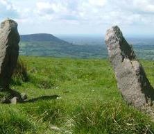
Stride out along the Gritstone Trail and sample some of the finest walking in Cheshire. There are stunning views in all directions from the gritstone ridges abutting the Cheshire plain. On a clear day you’ll see views to the Welsh hills and the cathedrals of Liverpool. Along the route there’s a variety of interesting landmarks and features.
Although the Trail is well waymarked you are strongly advised to use the Ordnance Survey Explorer map 268, Wilmslow, Macclesfield & Congleton, and the Explorer OL1 Dark Peak map. Explorer map OL24 is also useful, as it includes the Peak District to the east as well as covering the Trail from Bollington to Rushton Spencer.
The Trail is located on the edge of the Peak District. Walking the Trail from north to south is recommended. The Trail starts at Disley railway station, to the south east of Manchester and follows the Pennine edge southwards to finish at Kidsgrove railway station near Stoke on Trent. Road links to both ends of the Trail are good and other main roads cross the Trail in the middle section. Manchester Airport is nearby.
The Trail is very hilly but not mountainous, with several long climbs and some short, steep ascents and descents. There are many stiles, including ladder stiles along the way. Surfaces vary and can be rough, boggy or slippery. There are few facilities along the Trail so walkers need to be self sufficient in food and drink. The ability to read a map and use a compass is recommended although the route is well waymarked. Equipment should include walking boots, full waterproofs, warm clothing and a first aid kit. Before setting out always let someone know your intended route and estimated finish time. Mobile phones do not always work in some areas along the Trail.
The Trail is well waymarked using a mixture of fingerposts and yellow waymark discs with a ‘G’ in a footprint. Waymarks indicate the way to go as you stand directly in front of them. Often there is a clear path on the ground but sometimes the path is not obvious. Look out for stiles in hedges, fences or walls or waymark posts to guide you.